Intelligent Urban Planning & Decision Making AI
From Concept to Creation in 4 Steps
Simplifying the master planning process with an intuitive workflow.
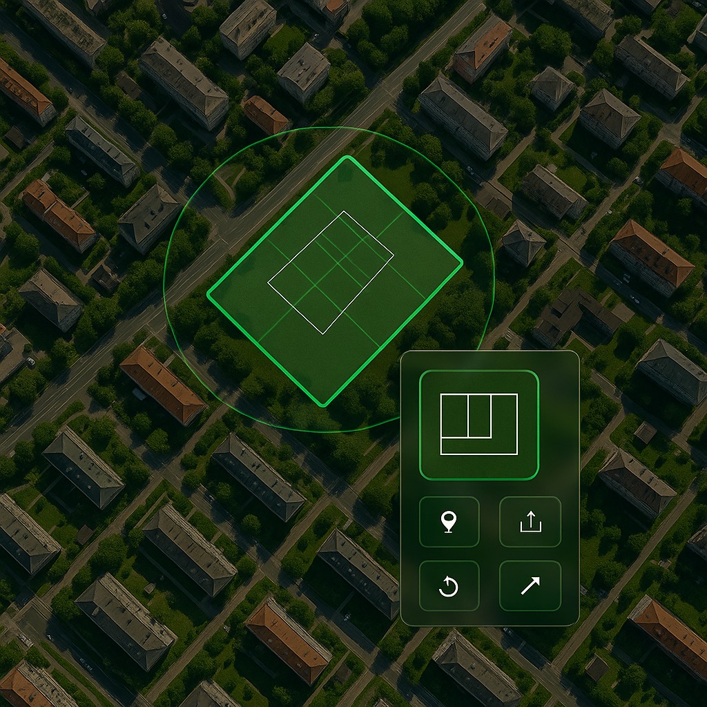
Step 1: Locate
Upload your survey file or pinpoint the land parcel directly on the map.
Step 2: Configure
Define your project requirements, constraints, and development goals.
Step 3: Customize
Select your preferred design styles and architectural preferences.
Step 4: Generate
Let our AI generate multiple optimized design solutions in minutes.
The Xylem Engine
Harness the power of AI to do more, faster. Our engine provides comprehensive analysis and visualization tools.
Geoplacement & Survey
- Extraction of survey information
- Geoplacement of survey diagram
- Relevant mapping overlays
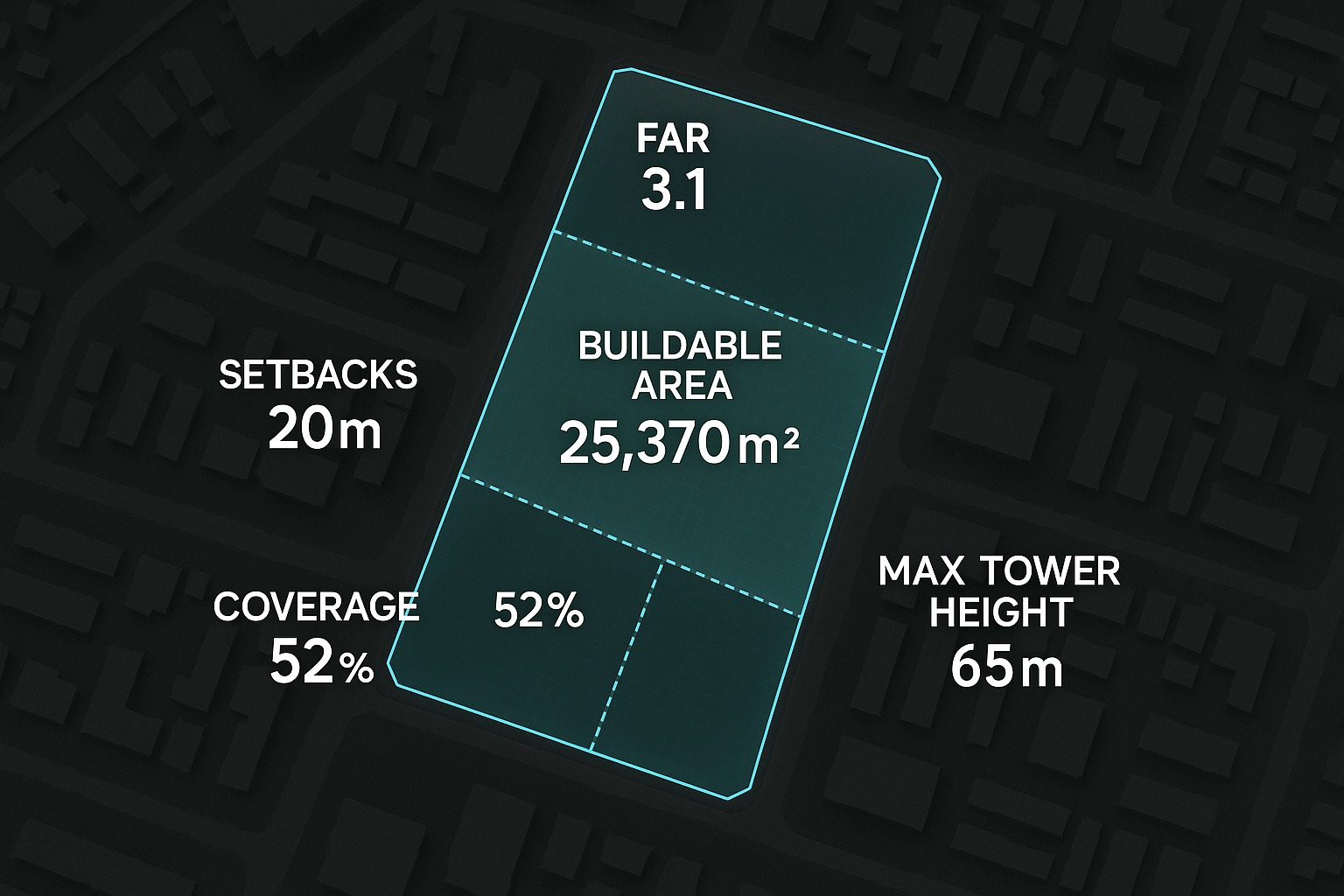
Feasibility Analysis
- Automated regulatory checks
- Buildable area calculation
- Identification of zoning compliance

Sustainability Analysis
- Daylight and shadow analysis
- Wind and micro-climate simulation

3D Visualization
- Multiple design schemes
- Performance evaluation for each scheme
- Ready-to-use files for designing
Explore the Possibilities
From large-scale city developments to specialized transport hubs, Xylem adapts to your needs.
Mixed-Use Complexes
Explore
City Development
Explore
15 Minute City
Explore
Smart Cities
Explore
Master Planning
Explore
Land Use Prediction
Explore
Transport Hubs
Explore
Hospitals
Explore